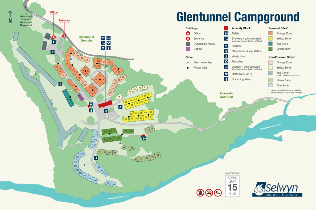
Xyst worked in collaboration with Selwyn District Council to create an updated and accurate map layout of the campground to guide visitors through the upgraded space.
The map was crafted using high-resolution drone imagery and incorporates essential features such as campsite locations, amenities, recreational facilities, and nearby attractions. Clear labeling, legends, colour-coding and directional markers make the map easy to follow.


