Passive Park Asset Mapping

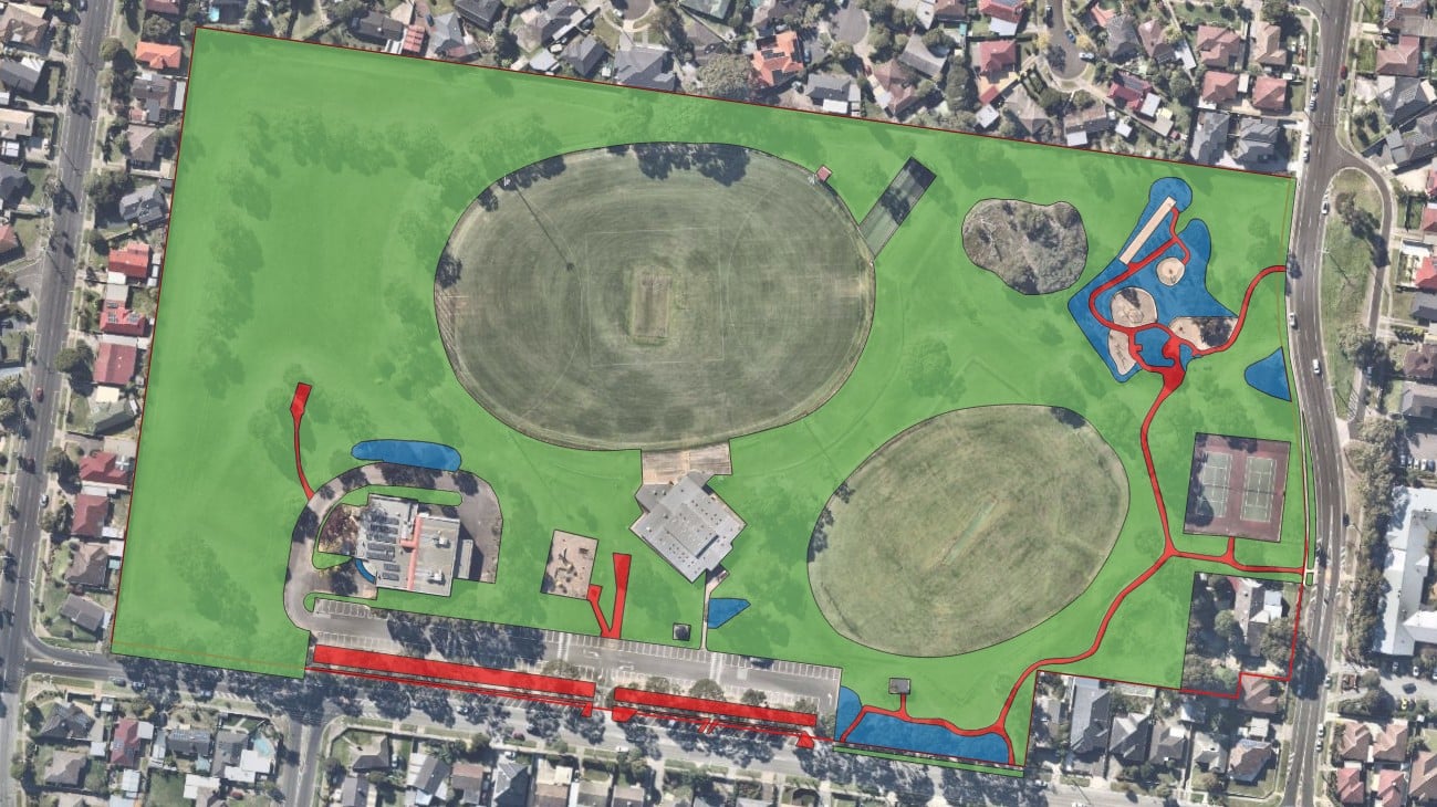
Xyst worked collaboratively with the City of Greater Dandenong (CGD) to develop a comprehensive spatial inventory of the municipality’s passive park assets, including grassed areas, garden beds, and granitic surfaces.

The mapping was undertaken as a desktop exercise using QGIS digitising tools and up-to-date aerial imagery.

To ensure the accuracy of the final dataset, the mapping was reviewed on a site-by-site basis by the CGD team.

Project Benefit

Through the spatial mapping of passive park assets, the City Presentation Team now has a comprehensive understanding of the assets they are responsible for, including their location, extent, and the total area under management. This information provides a strong foundation for more informed decision-making, enabling Council to improve operational efficiencies, optimise resource allocation, achieve value for money, and enhance service delivery. The resulting spatial dataset is also essential for supporting future procurement and tendering acitivities, ensuring they can be undertaken fairly, transparently, and competitively.
Client organisation
City of Greater Dandenong
Research
GIS Analysis and mapping